These maps were created by a professional cartographer. The numerical designations along the border of each map represent actual latitude and longitude coordinates—latitude measures distance north or south of the Equator, and longitude measures distance east or west of the Prime Meridian.
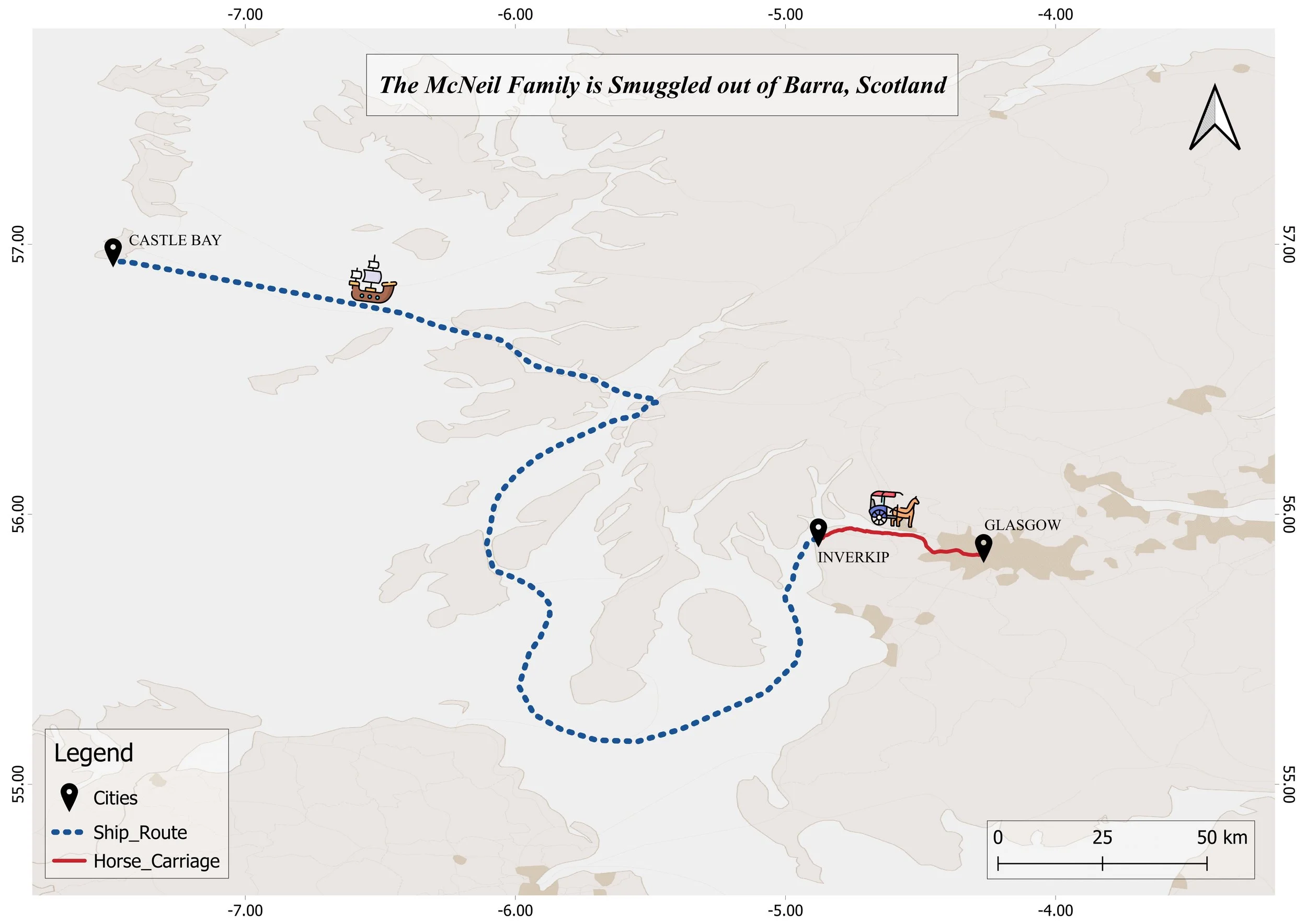
Map 1. The McNeil Family Is Smuggled out of Barra, Scotland (Chapters I–II)
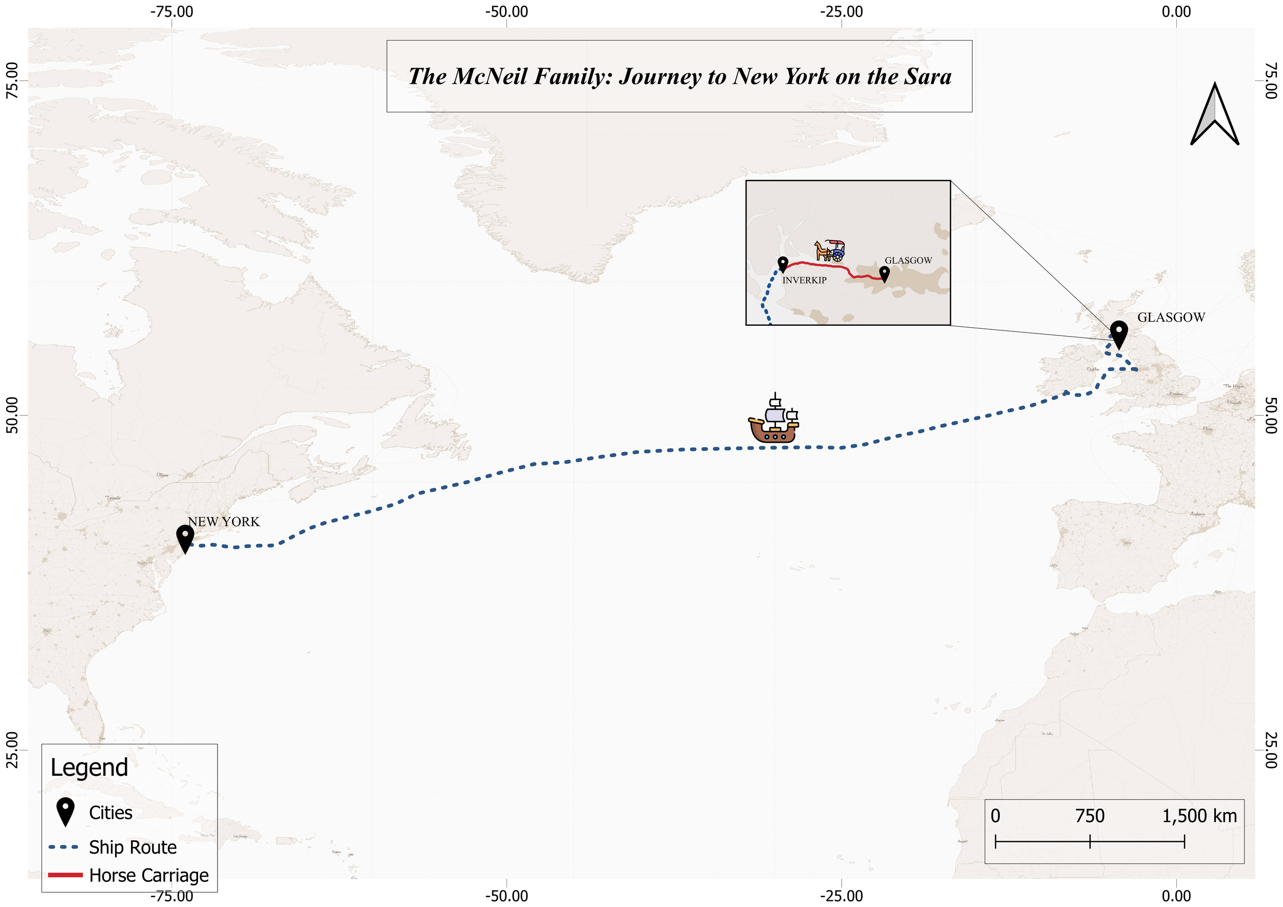
The McNeil Family’s Atlantic Passage to New York aboard the Sara (Chapter III)
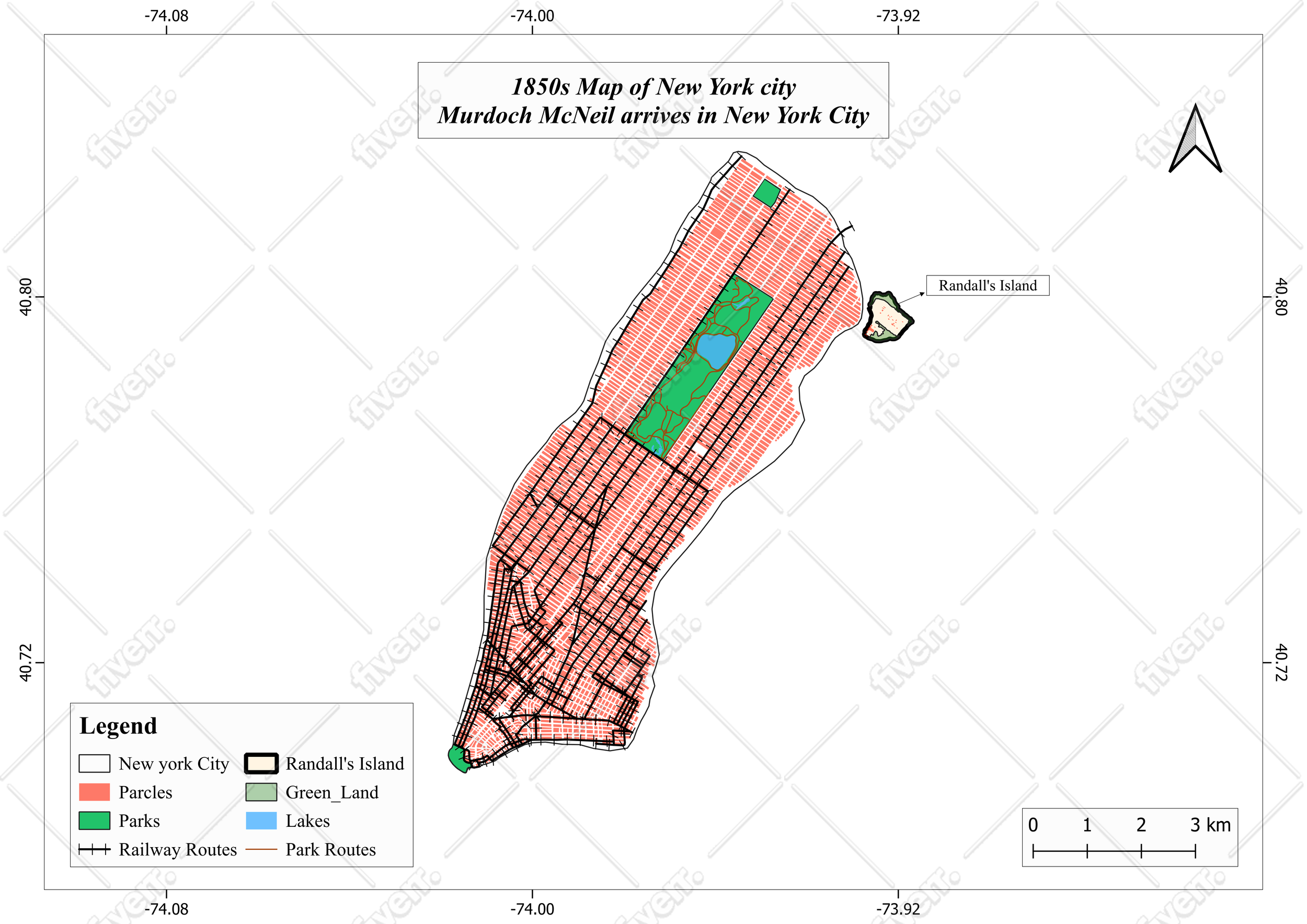
Map 3. 1850s Map of New York City: Murdoch McNeil’s Arrival and Processing in New York City (Chapter IV)
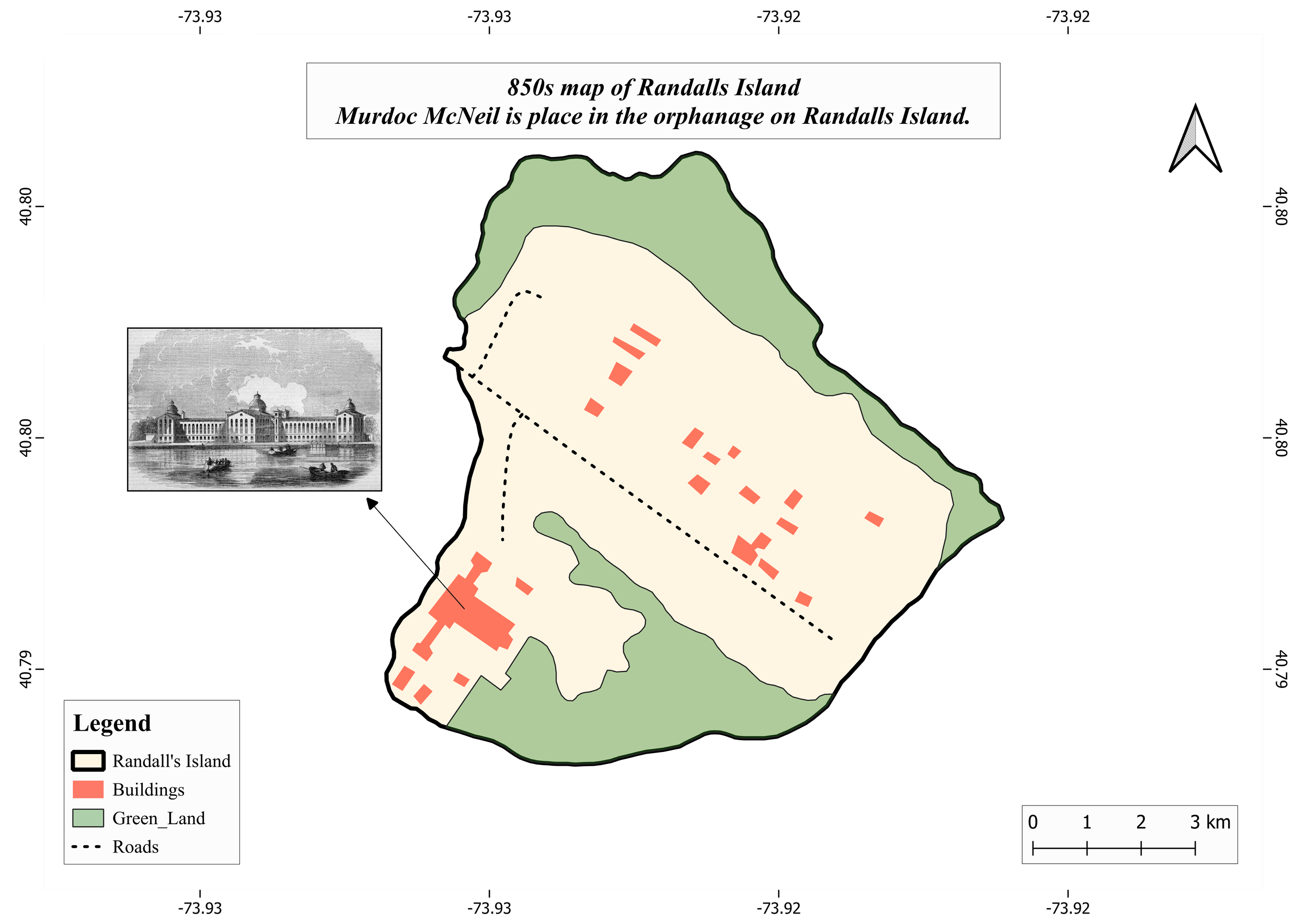
Map 4. 1850s Map of Randall’s Island: Murdoch McNeil Is Placed in the Orphanage on Randall’s Island (Chapter IV)
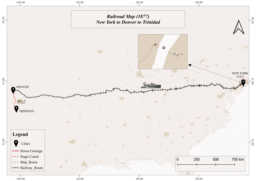
Map 5. Railroad Map (1877): The McNeils’ Westward Journey from New York to Denver (Chapter X)

Map 6. Road Map (1877): The McNeils Travel by Wagon from Trinidad to Raton over the Treacherous Raton Pass (Chapter X)
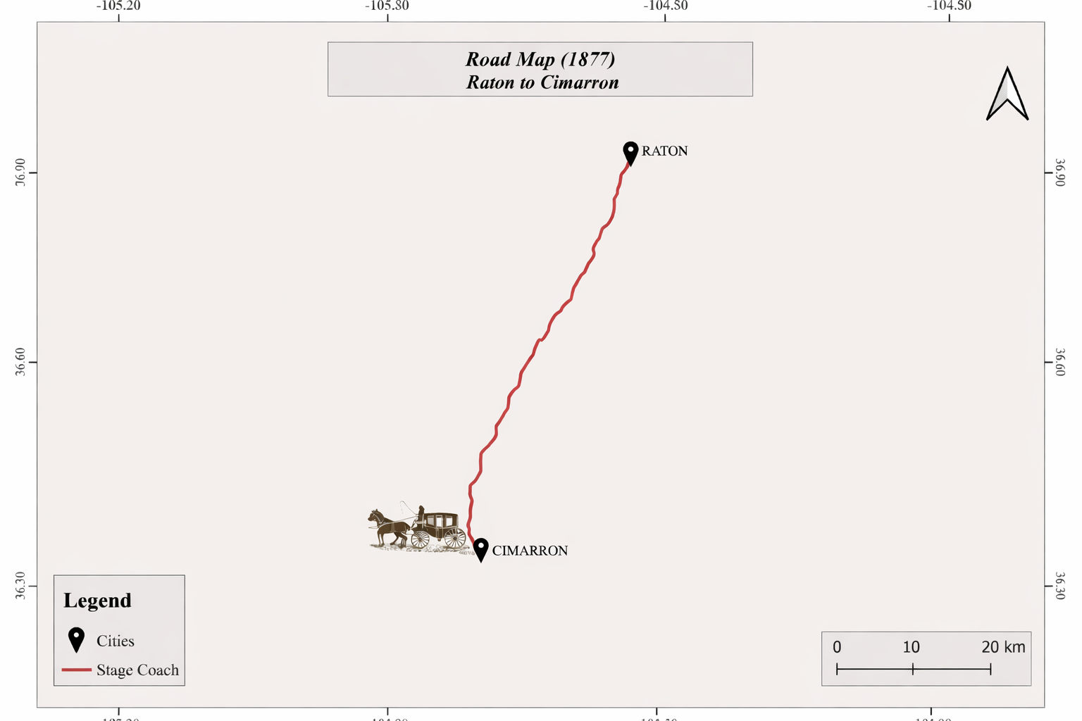
Map 7. Road Map (1877): The McNeils’ Isolated Wagon Journey from Raton to Cimarron (Chapter X)
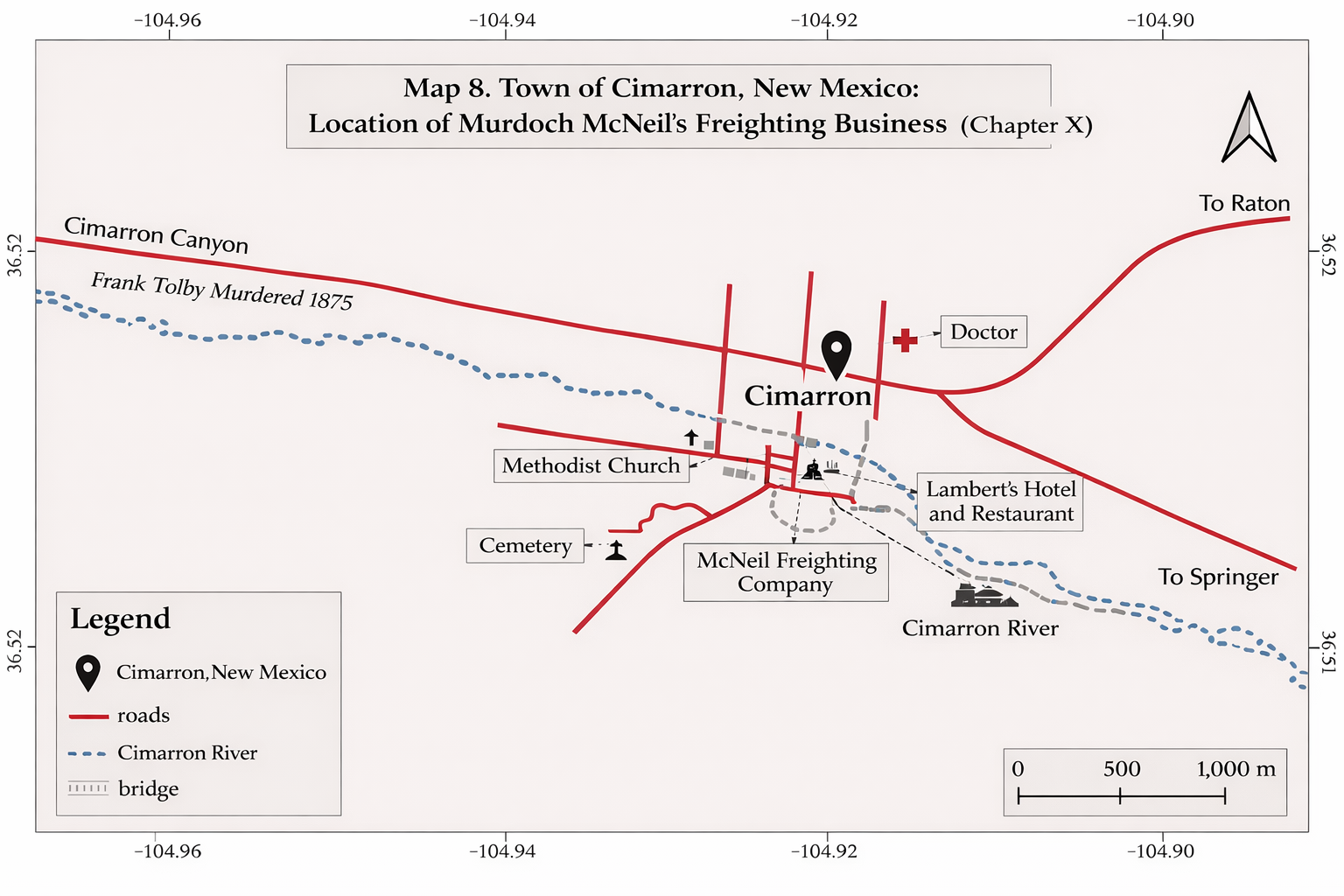
Map 8. Cimarron, New Mexico: The McNeil Freighting Business (Chapter X)
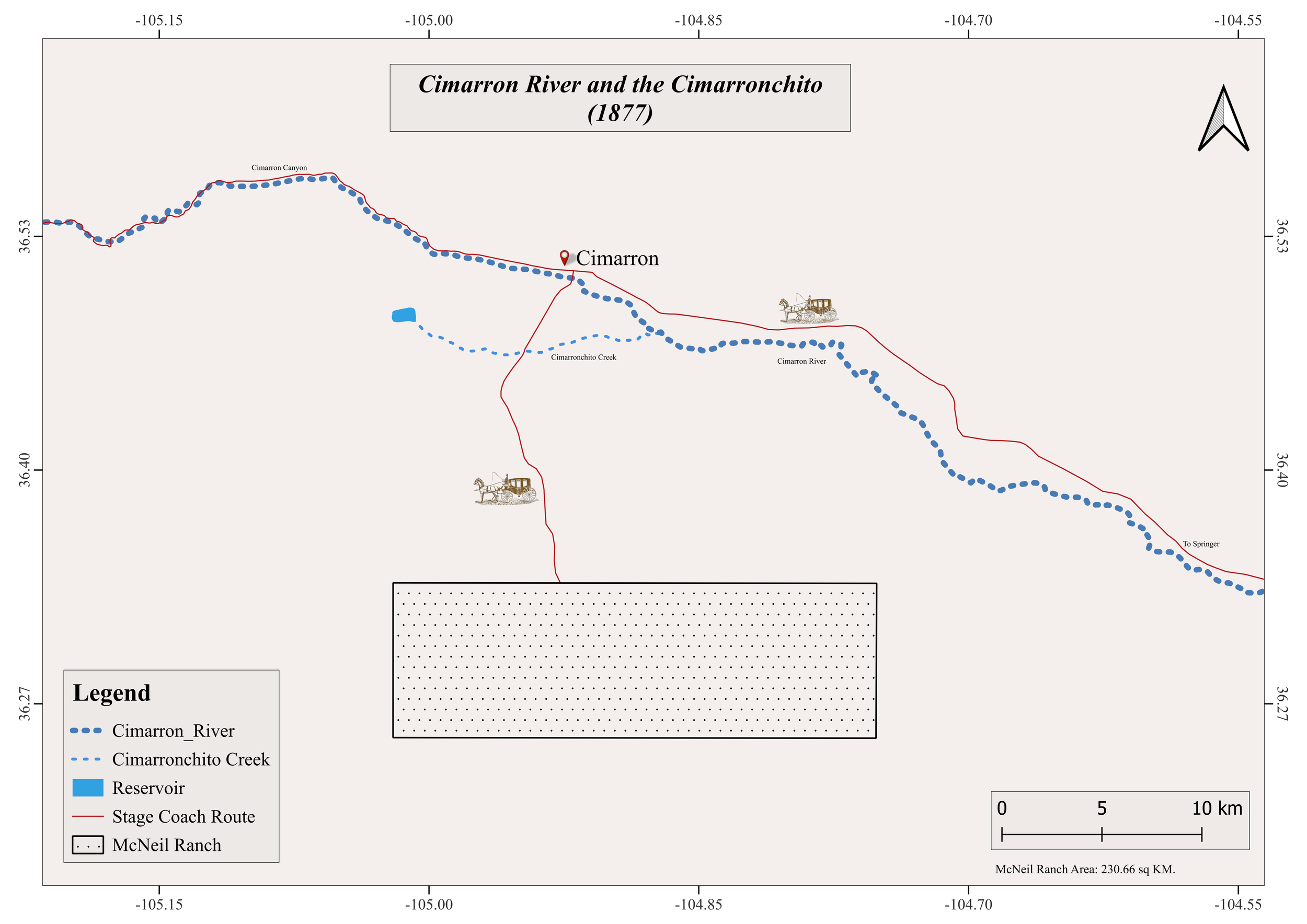
Map 9 The McNeil Ranch
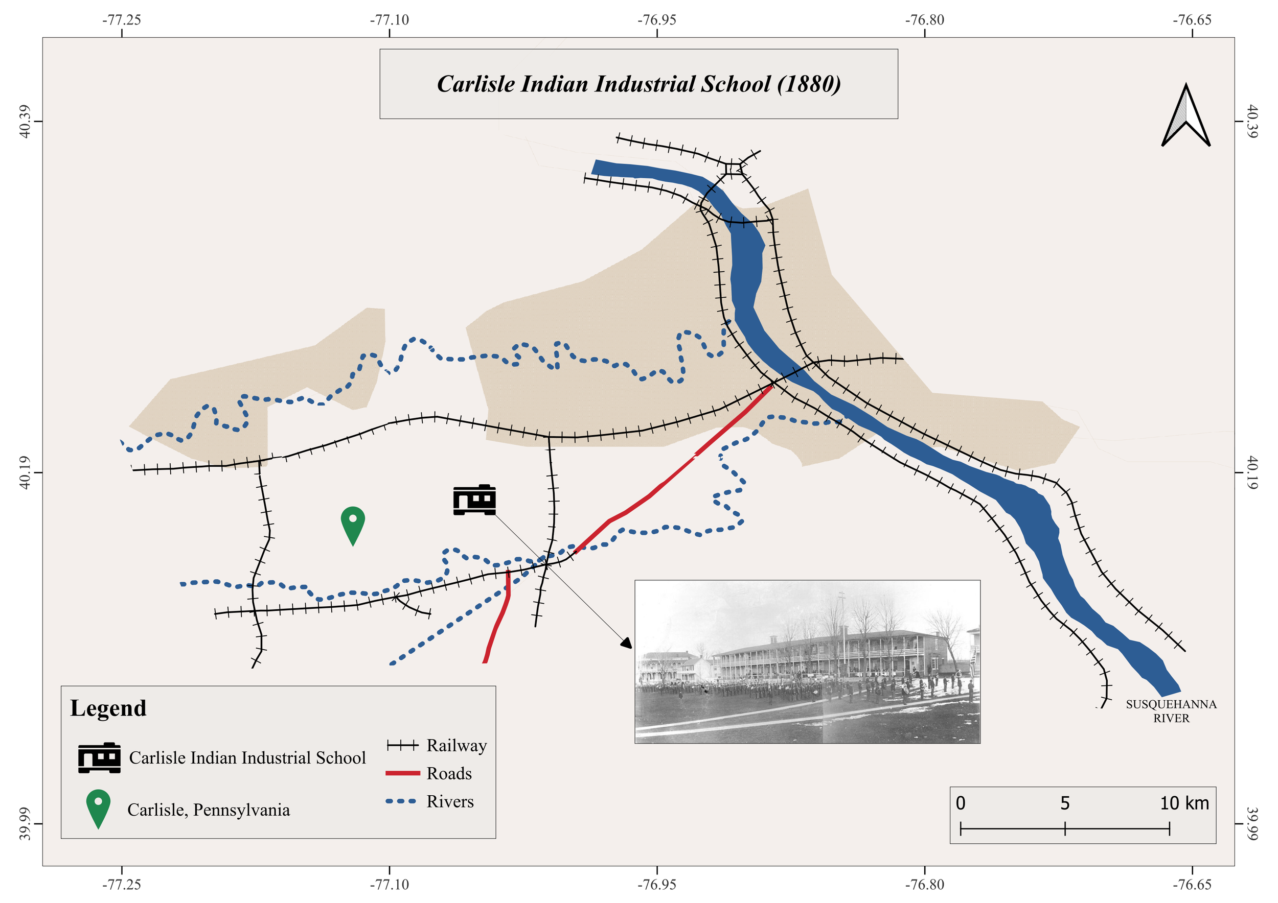
Map 10. Carlisle Indian Industrial School, Pennsylvania: Kewanee Arrives by Train in the Middle of the Night (Chapter XIII)
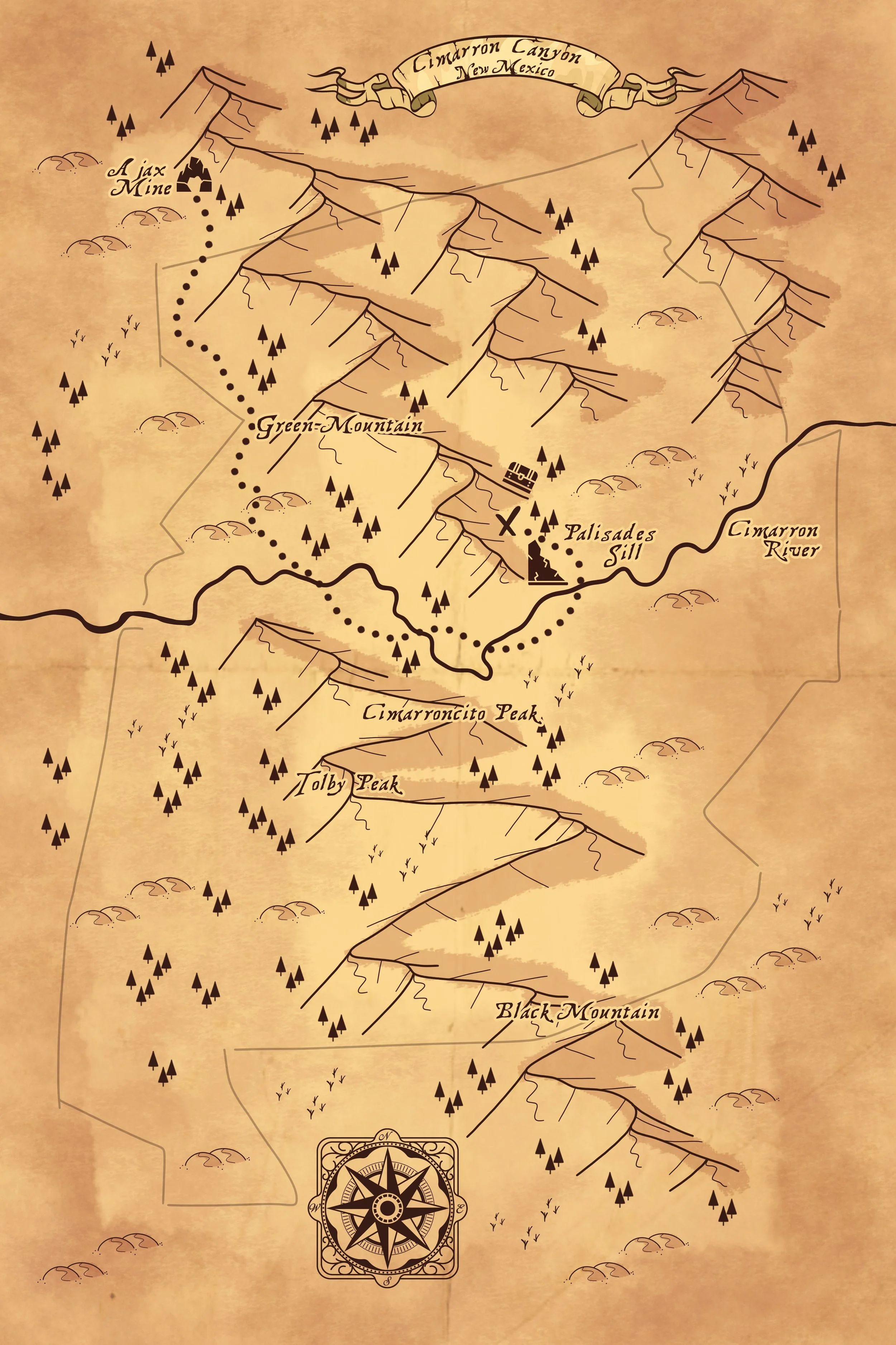
Map 11. Treasure Map of Cimarron Canyon (Chapter XXII)