These maps were created by a professional cartographer. The numerical designations along the border of each map represent actual latitude and longitude coordinates—latitude measures distance north or south of the Equator, and longitude measures distance east or west of the Prime Meridian.
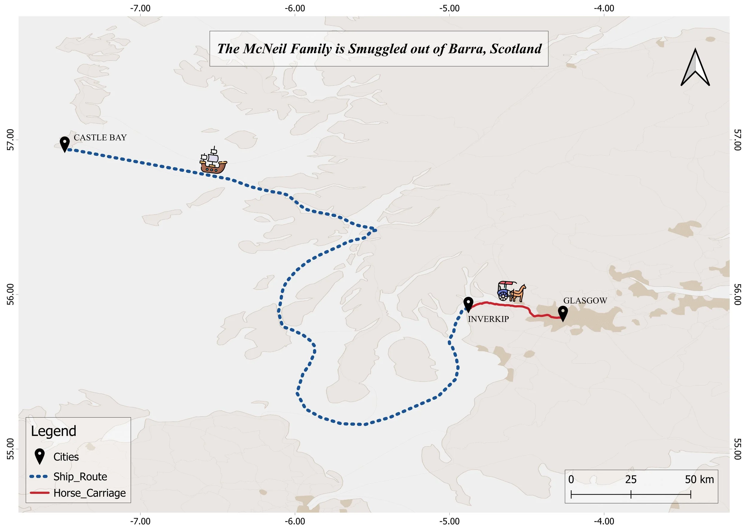
Map showing the ship route from Inverkip to Castle Bay in Scotland, with a horse carriage route connecting to Glasgow, and a legend indicating cities, ship route, and horse carriage route.

Map 1. The McNeil Family Is Smuggled out of Barra, Scotland (Chapters I–II)
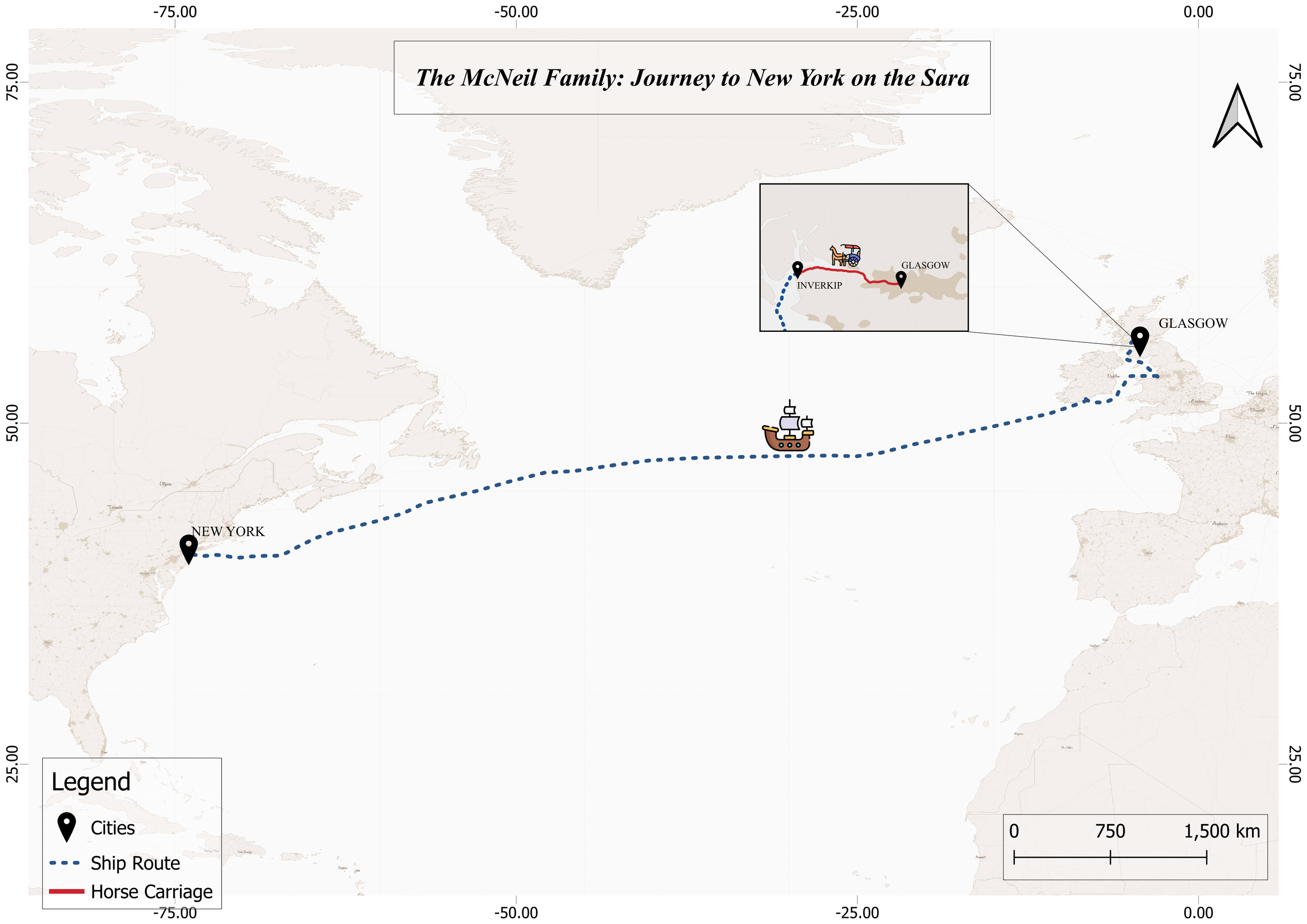
Map showing the McNeil family's journey from Glasgow, then by steamer across the Atlantic to New York City.

The McNeil Family’s Atlantic Passage to New York aboard the Sara (Chapter III)
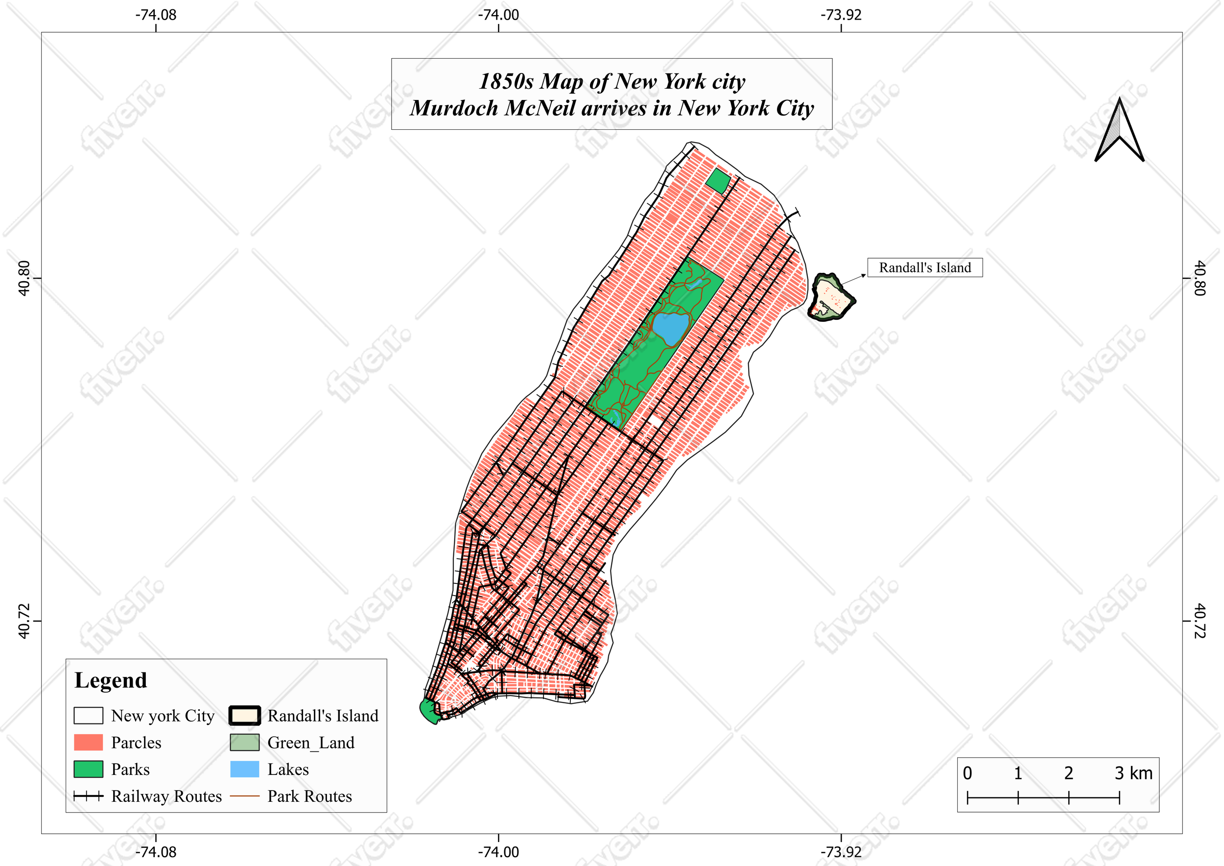
Map of New York City from 1850s showing Parcels in red, Parks in green, Lakes in blue, Rails and Park Routes, Randall's Island, and the arrival of Murdoch McNeil.

Map 3. 1850s Map of New York City: Murdoch McNeil’s Arrival and Processing in New York City (Chapter IV)
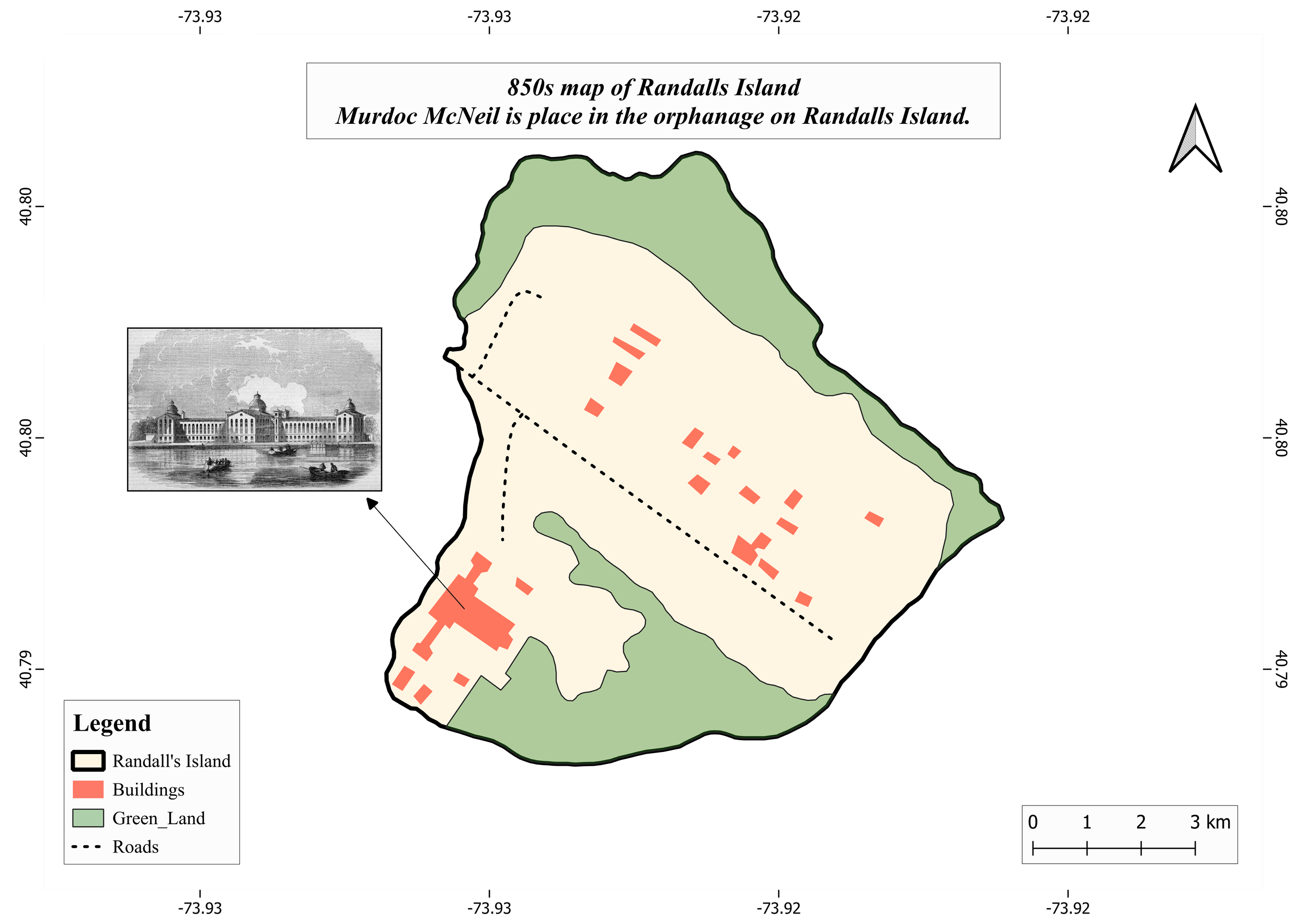
Map of Randalls Island showing land use areas with legend for buildings in red, green land in green, and roads in dashed lines. An inset in the lower left corner features a black and white photograph of a large building on Randall's Island

Map 4. 1850s Map of Randall’s Island: Murdoch McNeil Is Placed in the Orphanage on Randall’s Island (Chapter IV)
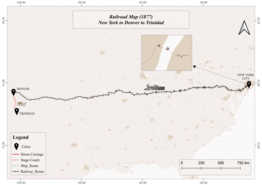
Map showing a 1877 railroad route from New York City to Denver and Trinidad, with details of cities, horse carriages, ship route, stagecoaches, and railway route, including an inset map of the route.

Map 5. Railroad Map (1877): The McNeils’ Westward Journey from New York to Denver (Chapter X)

Map showing the route of the Raton Pass from New Mexico to Trinidad, Colorado, including key locations such as Raton, Trinidad, and Raton Pass. The route is marked with a red line and stagecoach icons, with a legend explaining symbols for cities, Raton Pass, and stagecoach routes.

Map 6. Road Map (1877): The McNeils Travel by Wagon from Trinidad to Raton over the Treacherous Raton Pass (Chapter X)
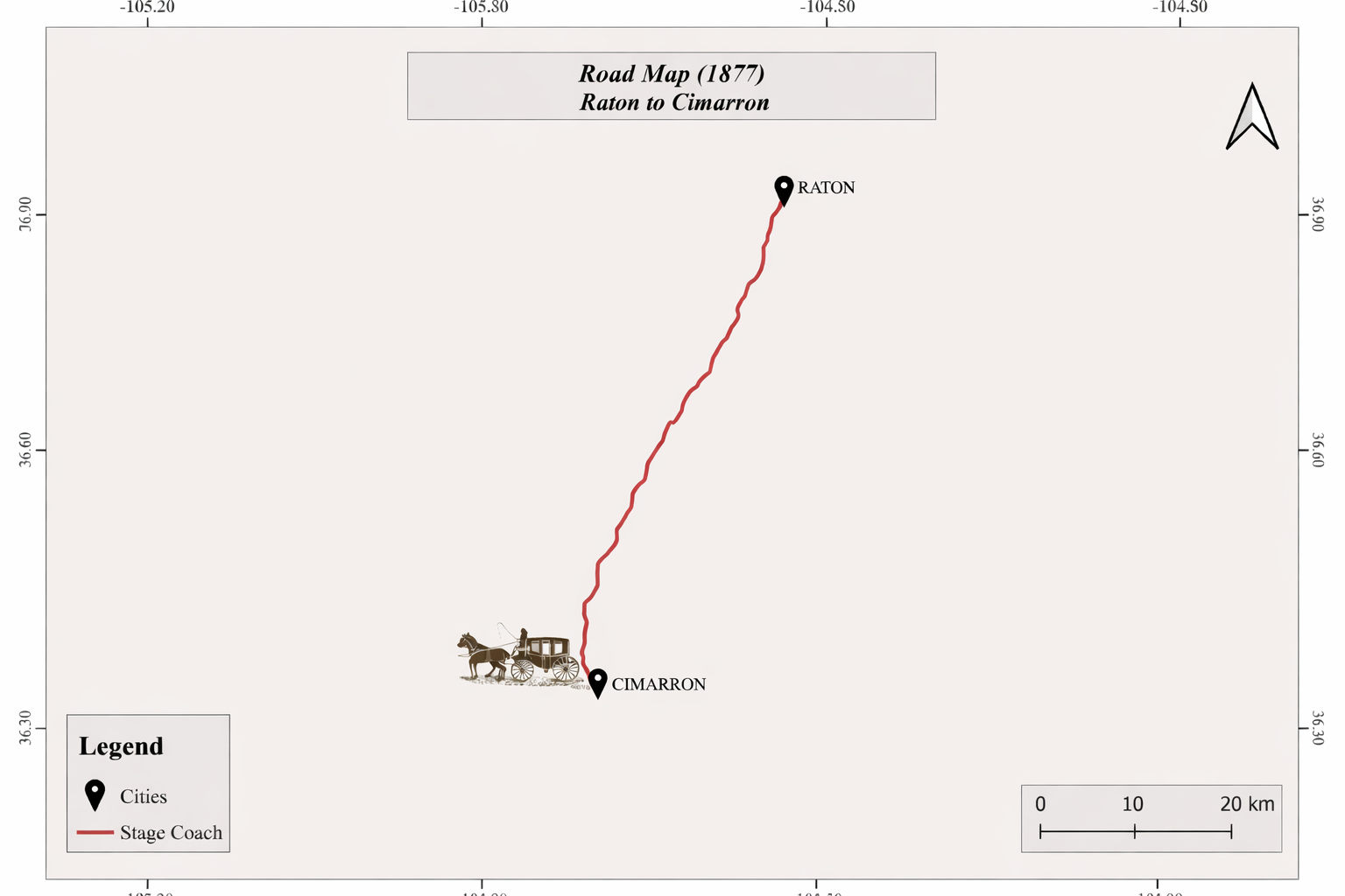
A historical map of the 1877 road route from Raton to Cimarron, showing a red line between the cities with icons of a stagecoach, and a legend indicating city locations and stagecoach route.

Map 7. Road Map (1877): The McNeils’ Isolated Wagon Journey from Raton to Cimarron (Chapter X)
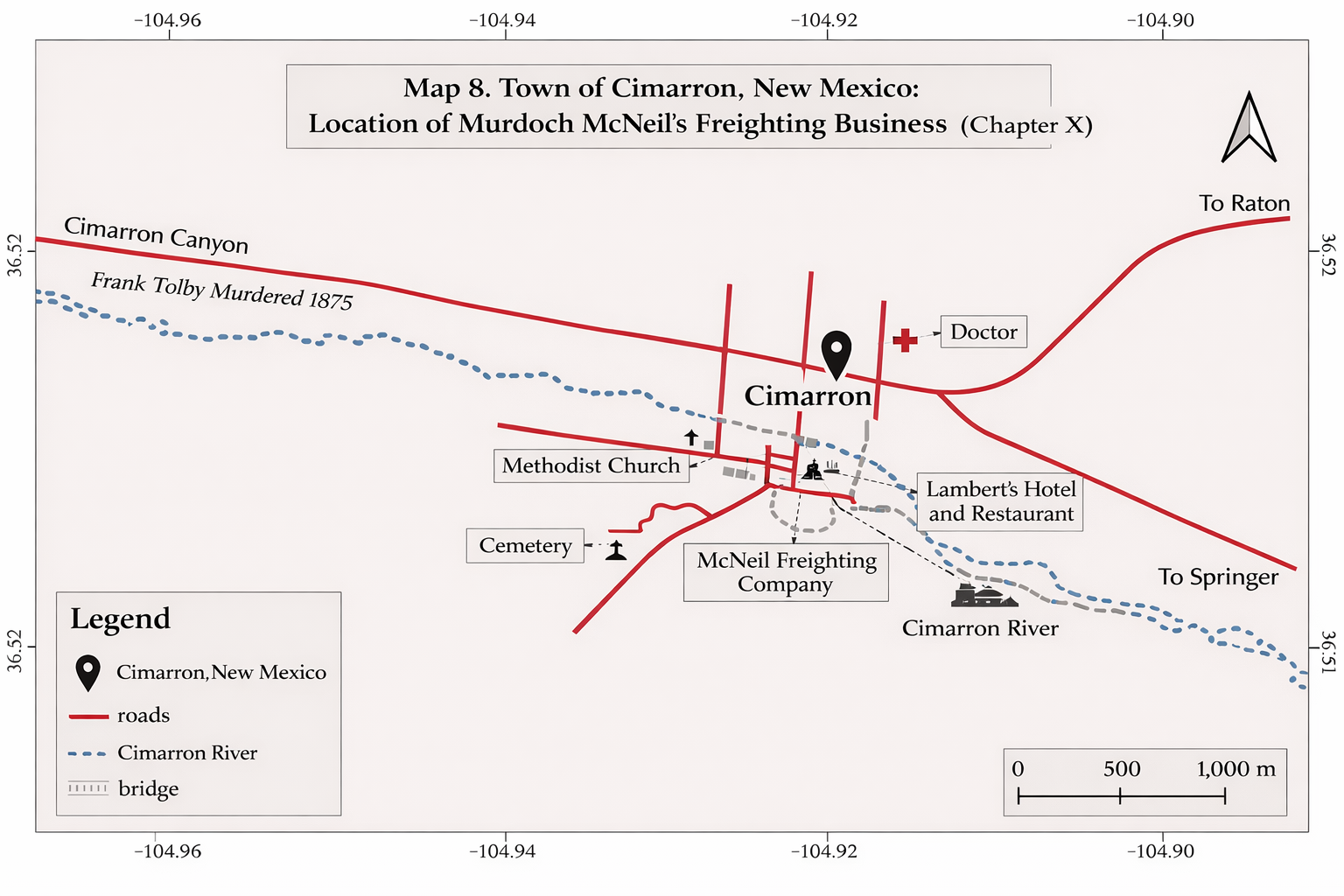
Map of Cimarron, New Mexico, showing roads, Cimarron River, and key locations including the McNeil Freighting Company, Methodist Church, Cemetery, doctor, Lambert's Hotel and Restaurant, and the Cimarron River, with directions to Raton and Springer.

Map 8. Cimarron, New Mexico: The McNeil Freighting Business (Chapter X)
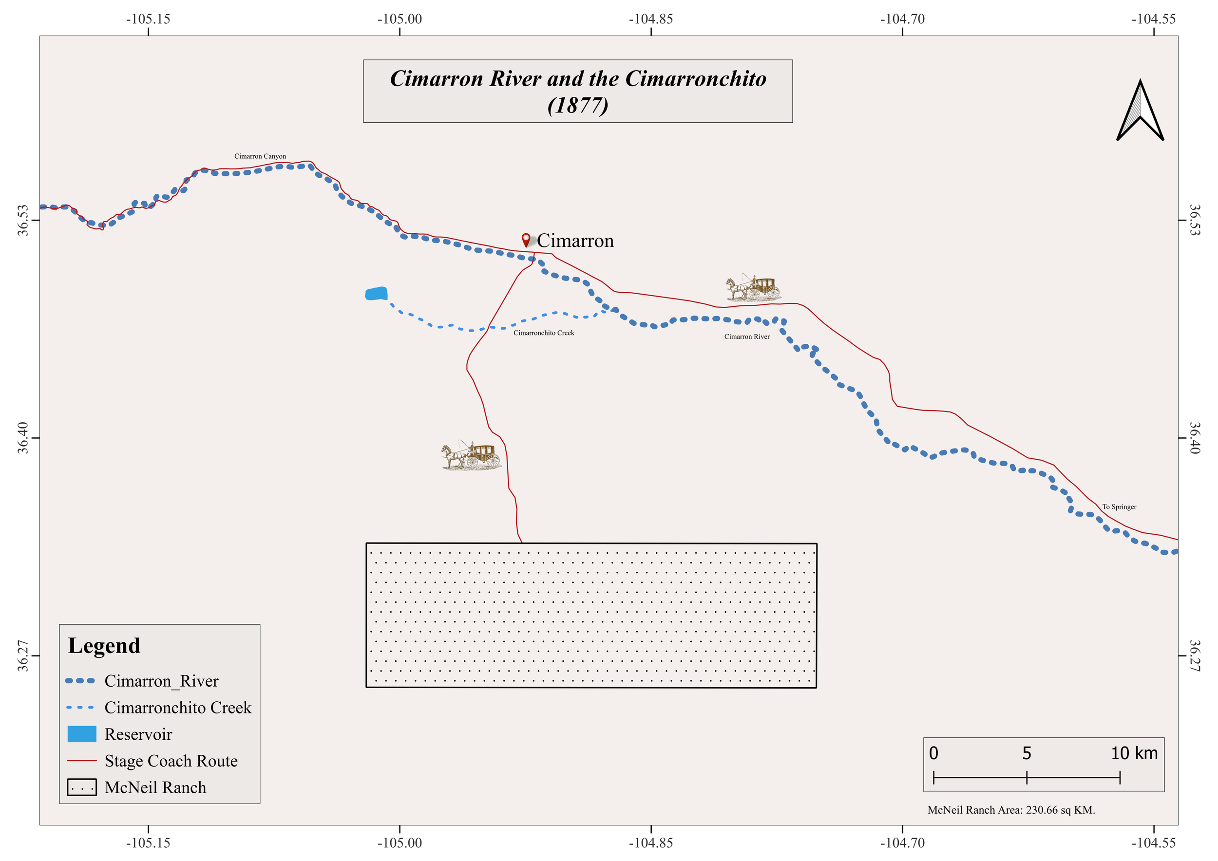
Map of the Cimarron River and Cimarronchito area, showing the Cimarron River, Cimarroncito Creek, reservoir, Stage Coach Route, and McNeil Ranch, with legend and scale.

Map 9 The McNeil Ranch

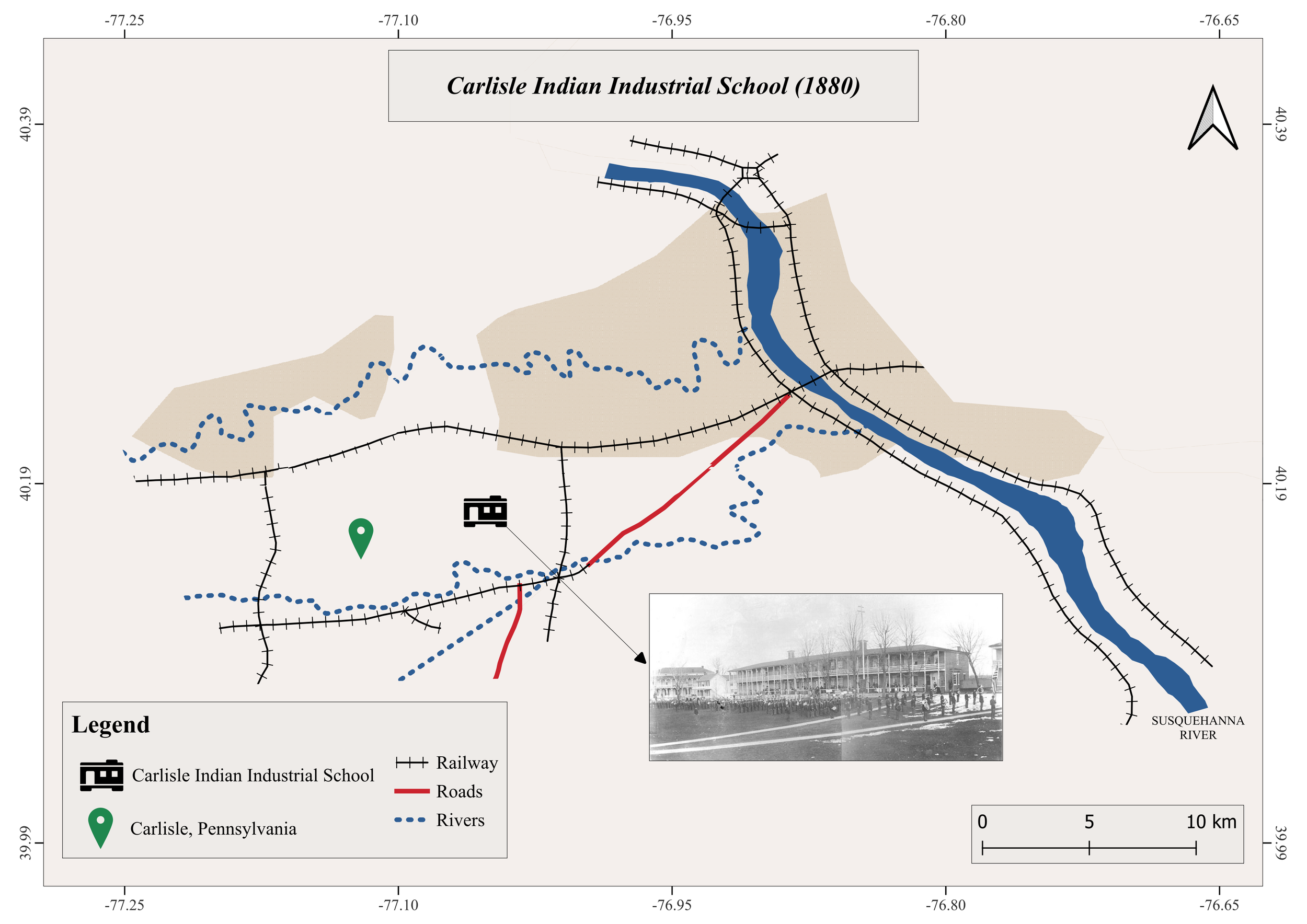
Map of Carlisle, Pennsylvania, showing the Susquehanna River, railway lines, roads, and the Carlisle Indian Industrial School founded in 1880. There is a black and white historical photo of the school at the bottom right corner.

Map 10. Carlisle Indian Industrial School, Pennsylvania: Kewanee Arrives by Train in the Middle of the Night (Chapter XIII)
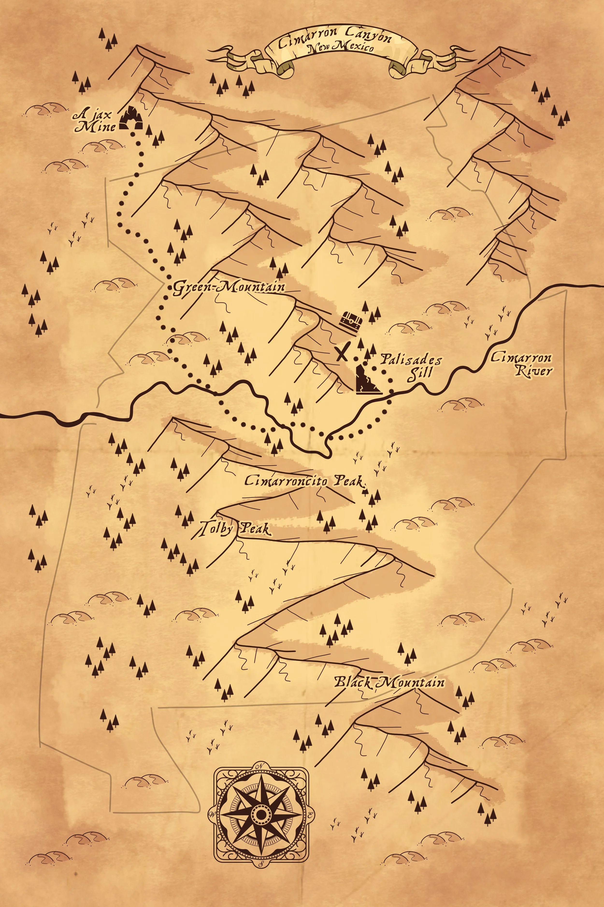
A vintage-style map showing Cimarron Canyon in New Mexico, with landmarks such as Cimarron River, Palisades Sill, Cimarroncito Peak, Tolby Peak, Black Mountain, and notable features like an abandoned mine, mountain ranges, and a compass rose.

Map 11. Treasure Map of Cimarron Canyon (Chapter XXII)